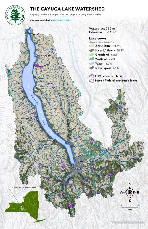
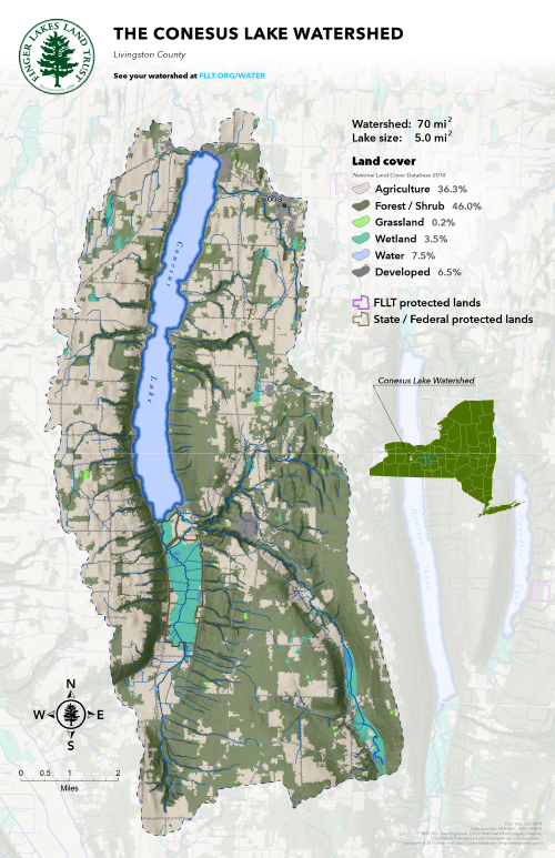
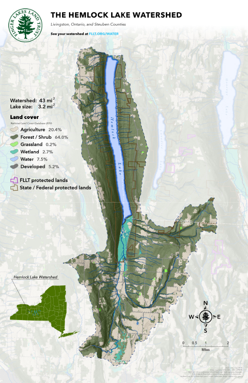
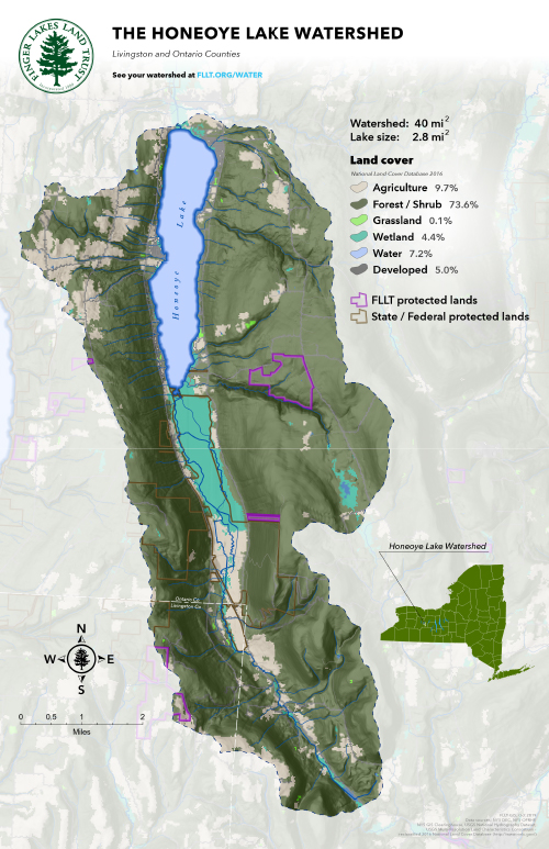
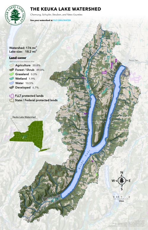
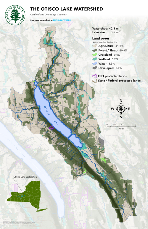
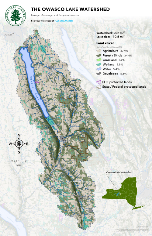
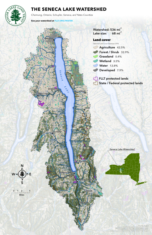
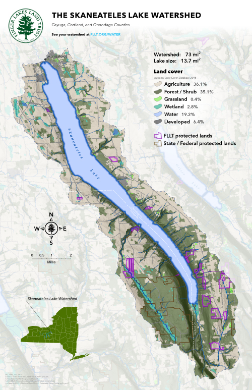
Water Quality > Watershed Maps
The Finger Lakes Land Trust has created these maps and charts to enhance your understanding of the watersheds in our region.
Maps and charts on this page may be used for noncommercial purposes provided that they are not altered and are credited to Finger Lakes Land Trust unless otherwise noted. Higher resolution files are available to members – join FLLT today. Please contact us with questions.
The Finger Lakes Region
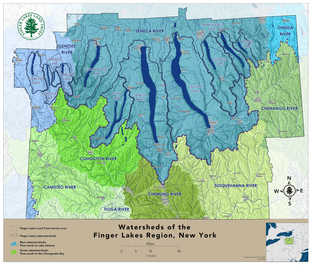
This map shows all the watersheds within the Finger Lakes Land Trust conservation service area, including the 11 Finger Lakes watersheds. The region is split between north-flowing (to Lake Ontario) and south-flowing (to Chesapeake Bay) watersheds.
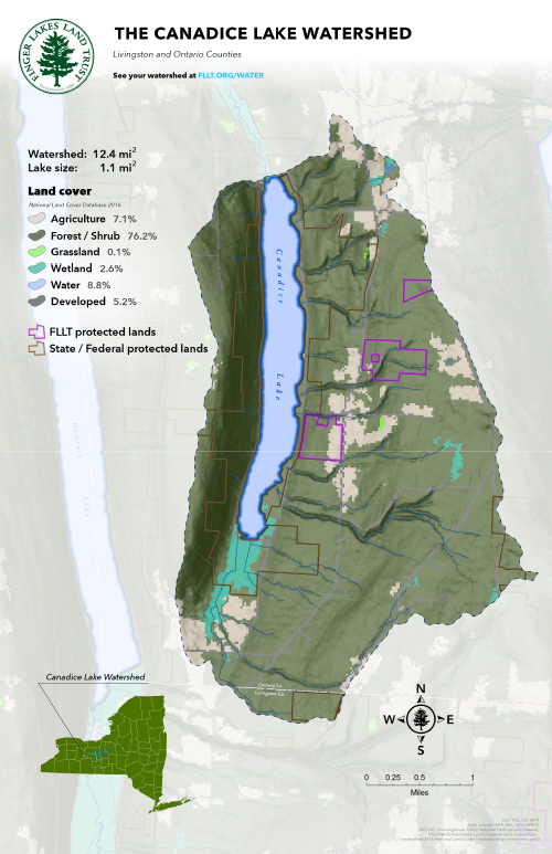
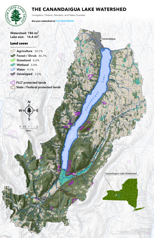
The 11 Finger Lakes Watersheds
Land cover among the 11 lake watersheds. The Finger Lakes Land Trust works with our partners across the region to save lakes, streams, and drinking water.
Land Cover Across the Region
Comparative land cover in the 11 Finger Lake watersheds.

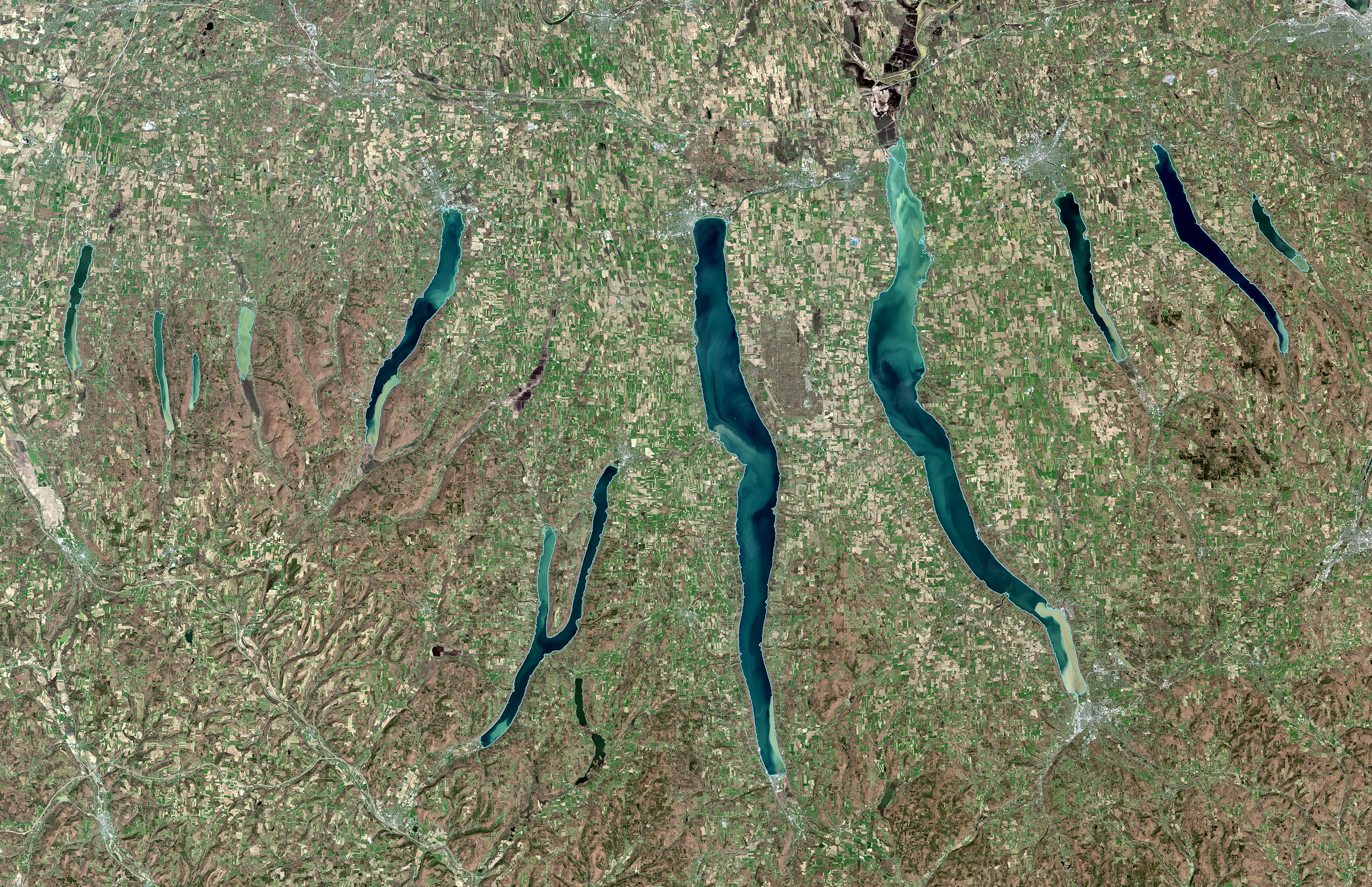
Finger Lakes Region from Satellite
Large sediment plumes visible from space in the 11 Finger Lakes after spring snowmelt and rain. Landsat 8 image, April 23, 2017.
ACT NOW
Help the Land Trust protect more land and water forever
Make your gift to the Finger Lakes Land Trust to advance our work protecting sensitive lands and waters, and increasing regional public awareness of the toxic algae threat.