The dramatic landscapes, gorges, and waterfalls of the Finger Lakes region resulted from a combination of two different geologic factors–the underlying bedrock and the much more recent glaciations.
The bedrock formed as a result of the slow accumulation of sediments in a shallow inland sea some 400 to 355 million years ago. The subsequent burial, to depths that may have exceeded 10,000 feet, turned the soft sediment into rock (known as lithification). Tectonic forces deep in the Earth over millions of years uplifted and warped these rocks. The uplift caused progressive erosion of the rock surface to a point where it generally resembled today’s landscape but without the deep Finger Lake valleys. At least 10 and possibly 20 continental-scale glaciations over the last ~ 2.5 million years deeply eroded the preexisting river valleys oriented generally parallel to the north-to-south ice-flow direction. Stream valleys not coincident with the ice flow were bypassed and often packed with glacially-derived sediment.
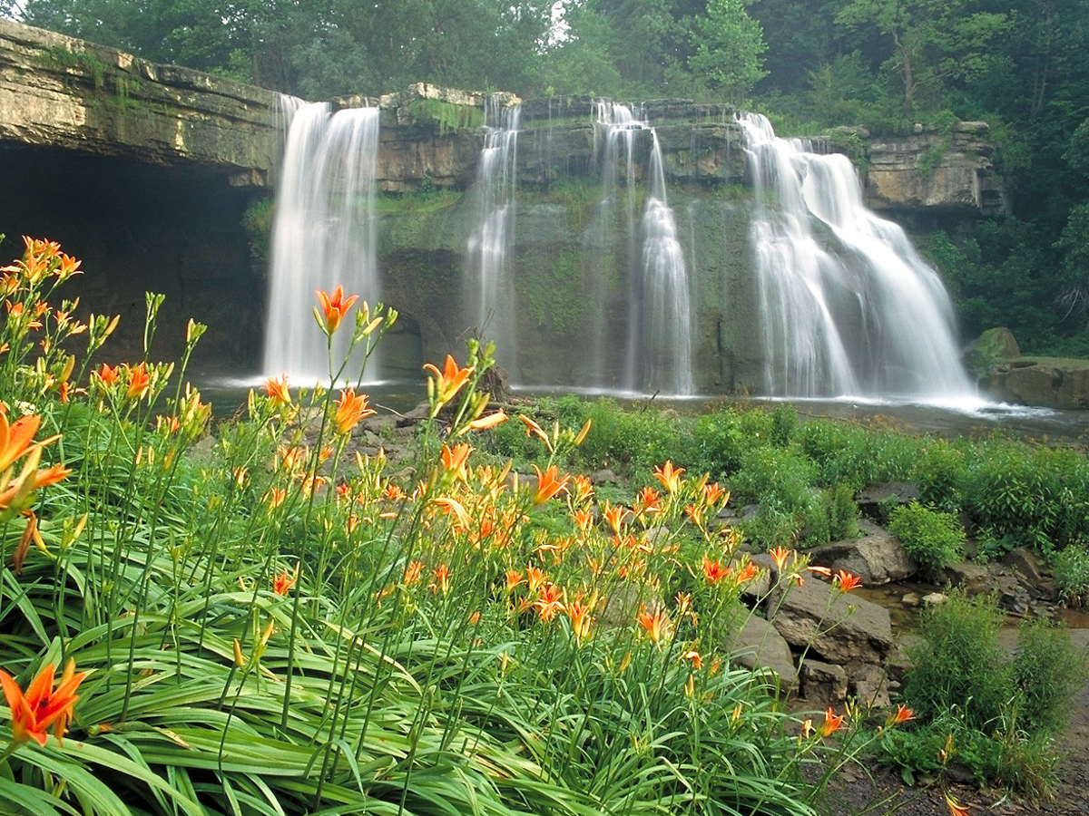
Ludlowville Falls Photo by Derek Doeffinger
The glacial erosion created steep valley sides with uplands on either side that can rise up to 1,000 feet above the adjacent lake surface. The tributary streams entering the lakes start high above the lakes, resulting in rapid erosion of the tributary valleys, producing steep gorges. As the erosion downcut into the underlying bedrock, the streams encounter intermixed layers of rock that differ dramatically in their resistance to erosion. For example, lithification of muds produces finely bedded shale; sands produce sandstone; and lime muds (similar to what might be found in the reefs around Bermuda and the Florida Keys) produce limestones. The fine bedding of the shales produces a very weak rock that is easily eroded. In contrast, sandstones and limestones tend to be very resistant to erosion.
This contrast in rock strength, combined with the large vertical drop of the tributary streams, is what causes waterfalls and riffles to form in the streams and gorges, because the weaker shale erodes much more quickly than sandstones or limestones. In cases where a particularly thick and strong rock layer sits above a thick and weak rock layer, dramatic falls can be produced.
A wonderful example of this is Tinker Falls in southeastern Onondaga County. The strong, resistant rock that forms the lip of the falls is the Tully Limestone, which sits above the Moscow shale. The Moscow shale is very susceptible to stream erosion in addition to wet-drying and frost-freeze erosion. The combination of the thick, strong limestone over the thick and very weak shale has produced the beautiful overhanging falls.
Carpenter Falls Photo: George Thomas
Tinker Falls is roughly four miles east of Tully, NY, where the Tully Limestone was originally described and named in 1838. Since that time, the limestone has been found to outcrop (be exposed at the Earth’s surface) as far east as the Chenango River and west to the eastern side of Canandaigua Lake. The limestone is thickest in the outcrop near Tinker Falls at around 30 feet and thins out and changes character at its western and eastern extent.
The sedimentary rocks in Central New York all tilt down (dip) gently to the south, such that they outcrop to the north but dive below the Earth’s surface further south. Given this dip direction and the topography of the lake valleys, the Tully Limestone outcrops along the eastern side of Canandaigua Lake, along the west and east sides of both Seneca and Cayuga lakes (but drops to or below lake level toward the southern end), and wraps around the west, south, and east sides of Owasco, Skaneateles, and Otisco lakes.
This outcrop pattern results in some beautiful scenery! Wherever there is a tributary stream on slopes crossing the limestone, a waterfall results. The Tully Limestone is responsible for Carpenter Falls on the west side of Skaneateles Lake; falls in the lower section of Fillmore Glen State Park in Moravia on the east the side of the Owasco Inlet valley; the undercut Ludlowville Falls on Salmon Creek and the falls at the Cayuga Shores Wildlife Management Area on the eastern side of Cayuga Lake; the lower falls at Taughannock State Park (visible from Highway 89); and the Seneca Mills Falls on the Keuka Outlet trail between Keuka and Seneca lakes. This is in addition to a multitude of smaller, and typically unnamed, falls across the region where small streams cross the outcrop.
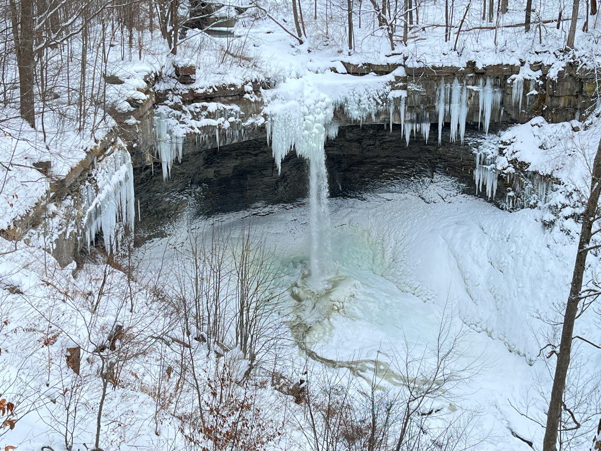
Winter is a great time to experience the dramatic landscapes of the Finger Lakes region and the ice-draped waterfalls that are 400 million years in the making.